Why Airspace Awareness Matters
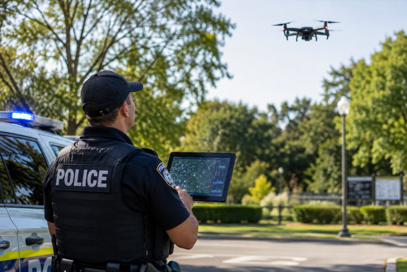
A police operation can be carefully planned on the ground and still be affected by an aircraft overhead. During a public event, a response near critical infrastructure, or a sensitive operation, an unidentified drone creates an immediate information gap: Is the flight authorized? Where is the aircraft going? Which team needs to know?
Drone detection for law enforcement helps close that gap. Instead of relying on a sighting alone, teams can use real-time airspace information to identify detectable drone activity, review available details, and follow established response procedures. AirSentinel is built around 360° airspace visibility, scalable monitoring, and actionable intelligence for law enforcement and first responders.
What Is Drone Detection for Law Enforcement?
Drone detection for law enforcement is the use of sensors and software to monitor drone activity in a defined area. AirSentinel AMS V8 provides 360° real-time detection of Remote ID and non-Remote ID drones, with deployment options for mobile or fixed operations. AMS V8 Pro is described as an advanced multi-band SDR system for precise identification of unauthorized drones, including custom-built and legacy UAVs.
The practical purpose of drone detection for law enforcement is straightforward: detect activity, deliver an alert, show available information, and help authorized personnel decide what happens next. AirSentinel does not jam signals or take control of drones. It is designed to inform and empower users while they apply their own security protocols.
How AirSentinel Builds Real-Time Awareness
Detect Remote ID activity
AirSentinel sensors are optimized for Remote ID signals. When a detectable Remote ID drone enters the monitored area, users can receive information associated with that activity rather than treating the aircraft as an unexplained object.
Identify selected non-Remote ID activity
Not every aircraft will provide the same identification data. AirSentinel states that its sensors can also detect some non-compliant or custom drones by identifying signal anomalies and device fingerprints. This gives drone detection for law enforcement relevance beyond Remote ID alone, without suggesting that every non-Remote ID aircraft can be identified.
Review location and flight path
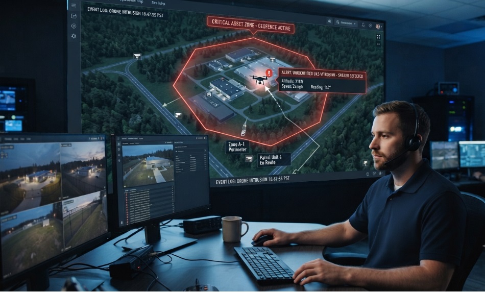
When a drone is detected, AirSentinel says users can receive details such as its ID, location, and flight path. These details help a team understand whether the aircraft is approaching a protected area, moving across an event perimeter, or remaining near a sensitive site.
Receive and share alerts
Real-time alerts place new activity in front of the people responsible for monitoring the airspace. AirSentinel’s cloud platform also supports shared alerts and watchlists, allowing partner agencies and organizations to work from the same operational information.
Where Law Enforcement Can Use It
Public events and stadiums
Large gatherings require awareness above the crowd as well as at entrances and perimeter lines. AirSentinel lists public events, universities, and stadiums among the environments it supports. A team can monitor the event airspace, receive an alert about detectable drone activity, and check whether the aircraft is part of an approved operation before escalating through its event-security process.
Correctional facilities
AirSentinel identifies correctional facilities as a use case involving contraband smuggling and unauthorized surveillance. For a facility team, drone detection for law enforcement can provide an additional source of information around the perimeter: an alert, available identification data, and a flight path that can be reviewed alongside existing security procedures.
Critical infrastructure, ports, and airports
AirSentinel lists critical infrastructure, oil and gas, mining, maritime facilities, ports, and airports among its supported environments. These sites may need continuous awareness of low-altitude activity around operational areas. AirSentinel’s stated focus is real-time detection, alerts, and airspace monitoring so responsible teams can recognize activity and coordinate an appropriate response.
VIPs, government, and sensitive operations
AirSentinel also lists VIPs and private property, military, and government operations. In these settings, a shared view of detected activity can help security personnel distinguish known operations from activity that requires attention, while keeping decisions with the authorized team.
AMS V8 and AMS V8 Pro
AMS V8 delivers 360° real-time detection of Remote ID and non-Remote ID drones and can be used in mobile or fixed deployments. AMS V8 Pro adds an advanced multi-band SDR system for precise identification of unauthorized drones, including custom-built and legacy UAVs.
The AirSentinel Cloud Platform provides real-time drone detection, alerts, and cloud-based airspace monitoring. AirSentinel states that first responders receive free access and that its pricing has no per-user fees. Unlimited users and watchlists support expansion as an agency adds personnel, sites, or partner organizations.
Mobile App
The AirSentinel Mobile App turns an Android phone into a free, real-time Remote ID drone detection tool. The website states a detection range of approximately 1,000–5,000 feet and says no account is needed. It also identifies iOS support as coming soon. Confirm current availability before publishing.
A Practical Response Workflow
A clear workflow keeps drone detection for law enforcement useful during a fast-moving incident:
- Set the monitoring area using the appropriate fixed or mobile deployment.
- Monitor for Remote ID and selected non-Remote ID activity.
- Review the real-time alert and available ID, location, and flight-path information.
- Share relevant alerts or watchlists with authorized partners.
- Follow the agency’s established security and communication procedures.
Why Simplicity and Scale Matter
AirSentinel describes its system as simple to deploy and intuitive to operate, including plug-and-play sensor installation and dashboards designed for organizations without a dedicated technology team. Its cloud-native model avoids server maintenance, while collaborative access allows multiple authorized users to monitor the same airspace picture.
The value of drone detection for law enforcement is therefore measured in clarity: a team can see that activity is present, review what the system knows, share the alert, and remain in control of the next decision.
Conclusion
Drones are now part of the operating environment around public events, correctional facilities, airports, infrastructure, and sensitive operations. Drone detection for law enforcement gives authorized teams a way to monitor that environment with real-time alerts and available flight information. AirSentinel combines 360° detection, Remote ID and selected non-Remote ID awareness, cloud monitoring, watchlists, geofencing, and mobile access in a scalable platform. Explore AirSentinel’s drone detection solutions or contact the team to discuss your airspace-monitoring needs.
Frequently Asked Questions
What is drone detection for law enforcement?
Drone detection for law enforcement uses sensors and software to monitor drone activity, provide alerts, and show available details such as identification, location, and flight path. AirSentinel provides these capabilities through its detection systems and cloud platform.
Can AirSentinel detect drones without Remote ID?
AirSentinel states that its sensors can detect some non-compliant or custom drones by identifying signal anomalies and device fingerprints, in addition to detecting Remote ID drones. The available result depends on the aircraft and detected signal.
What happens when AirSentinel detects a drone?
Users receive an alert with available information such as the drone’s ID, location, and flight path. The responsible team then decides how to proceed under its own security protocols. AirSentinel does not jam signals or take control of drones.
Can first responders use AirSentinel?
AirSentinel states that its Cloud Platform provides free access for first responders and does not charge per-user licensing fees. The platform provides real-time drone detection, alerts, and cloud-based monitoring.
Can a phone detect drones with AirSentinel?
The AirSentinel Mobile App turns an Android phone into a free, real-time Remote ID drone detection tool. AirSentinel states that it can detect Remote ID drones within approximately 1,000–5,000 feet, requires no account, and that iOS support is coming soon.

 BLOG · SEP 22, 2026