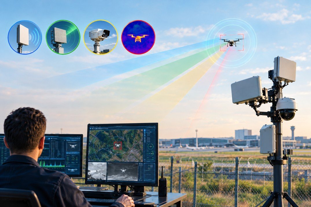
An alert is the start of the job, not the end of it. Once a drone enters a watched area, good drone detection software confirms what the aircraft is, follows its path, shows where the pilot is standing, checks whether the flight was expected, notifies the right people and saves a record for later review. Most of that happens in the first 60 seconds.
Speed matters. A small drone at 40 mph covers about 358 meters in 20 seconds. If the team spends that time asking whether the alert is real, the aircraft is over the stand, tank farm or runway approach before anyone moves.
The First Seconds of a Drone Detection Workflow
Confirming the Detection Is Real
Raw sensor hits are noisy. Wi-Fi routers, video links and parked drones all show up in the 2.4 and 5.8 GHz bands. The first step in any drone detection workflow is separating a live, airborne aircraft from background signals, so the operator sees one clean track instead of five flickering dots.
Where a site runs several sensors, drone detection software fuses them. RF supplies identity and position, radar confirms a physical object in the air, and a camera gives a visual check. A layered detection setup is what lets an operator trust the alert enough to act on it.
Reading What the Aircraft Is Broadcasting
Since the FAA Remote ID rule took full effect in March 2024, most drones flying in US airspace broadcast a message at least once per second. That message carries the aircraft identifier, its position, altitude and speed, and the location of the control station. Remote ID detection turns those fields into something readable within a second of reception.
Tracking the Drone Across the Site
Once confirmed, the aircraft becomes a live track. The drone detection dashboard plots its path, updates position as new data arrives and shows altitude, heading and speed. On a university campus or refinery, the operator sees at a glance which building or process area the drone is heading for.
Geofences and Zone Logic
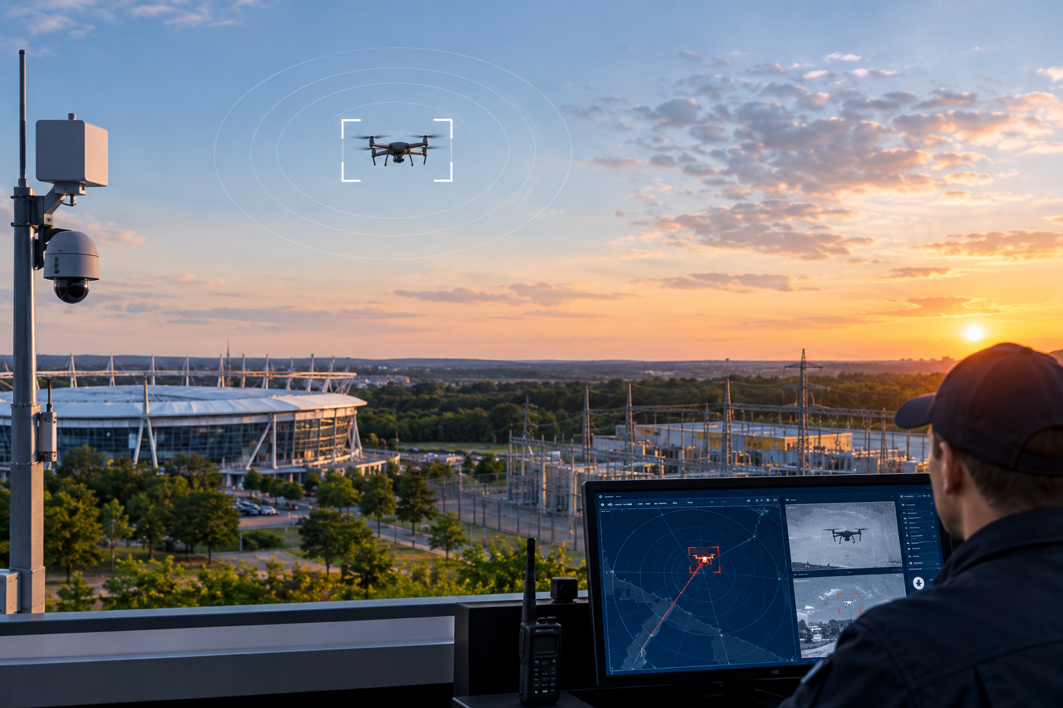
Monitored zones turn location into meaning. A drone 2 km out on a public road is a note in the log. The same drone crossing an inner boundary around a stadium bowl or a substation becomes a priority event. Drone detection software checks every track against these zones on each update and raises the alert level when a line is crossed.
A Practical Example
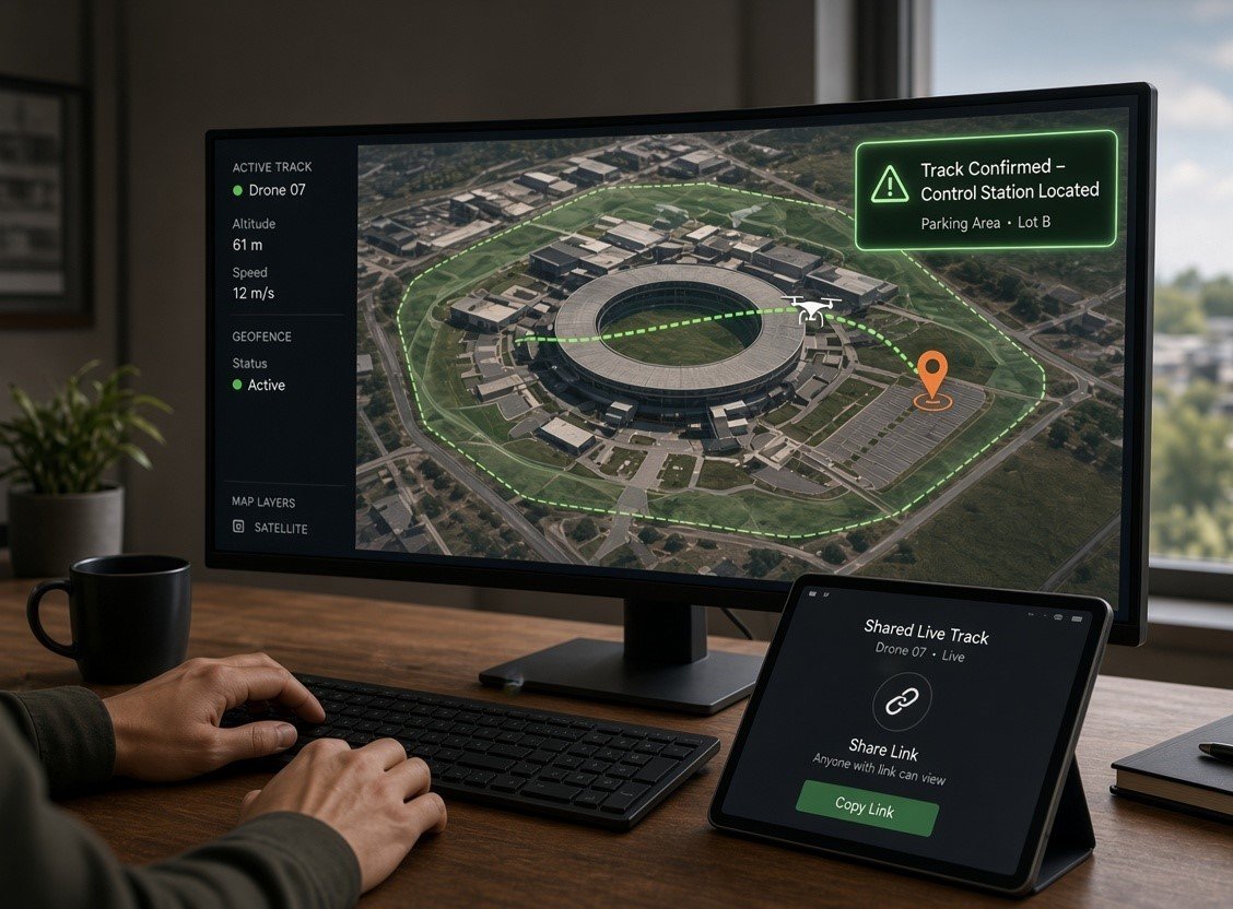
Picture a Saturday game at a 60,000 seat stadium under a temporary flight restriction. A track holds 1.5 km north for four minutes, then moves in. The drone detection software flags the entry and shows the control station in a parking lot two streets away, giving the command post a location to send officers before kickoff.
Locating the Pilot
Tracking the aircraft tells you where the risk is. Finding the pilot tells you how to resolve it. With Remote ID data, drone detection software can display the control station position and the takeoff point as separate markers, which is useful when a pilot launches from one spot and walks to another.
Most pilots are not malicious. They are hobbyists who skipped the airspace check or contractors whose paperwork never reached security, and a short conversation in person usually ends the flight.
Checking Whether the Flight Was Expected
Not every drone is unwelcome. Roof inspections, media crews and delivery trials fly near protected sites. The software checks each identifier against known aircraft and the authorized flights scheduled that day, so a planned inspection is not treated like an unknown aircraft circling a fuel depot.
Getting the Alert to the Right People
A detection on one screen in one control room is easy to miss. Drone alert software pushes the event to the people who own the response, through platform notifications, email or SMS, depending on how the site has set it up.
Security supervisors on patrol receive the location and a shared track link
Operations managers decide whether to pause outdoor work or crane lifts
Local police get a browser link to the live flight without needing an account
This is where drone alert software earns its keep, turning one operator detection into a coordinated drone detection workflow across teams.
Why This Matters in Emergencies
In January 2025, during the Los Angeles wildfires, a civilian drone struck a Super Scooper firefighting aircraft and grounded it mid response. Fire agencies, airports and event organizers now expect drone alert software to share detections in real time, not after the fact.
Recording the Event for Review
After the drone lands, the software keeps the record: time, identifier, path replay, pilot location and who was notified. That file supports police reports, insurance claims and internal reviews.
Spotting Repeat Visitors
Over weeks, patterns of life analysis shows whether an identifier keeps returning, when and from which direction. A drone at the perimeter fence at 6 am every Tuesday tells a different story from a single flight. Repetition is context, not proof of intent, but it helps teams plan patrols and sensor coverage.
What to Look For in a Drone Detection Dashboard
Live tracks delivered in under a second with clear source labels
Separate markers for aircraft, control station and takeoff point
Zones, known aircraft lists and watchlists the site team can edit
Shareable flight links for partners outside the organization
Replay, export and open APIs for existing security platforms
A drone detection dashboard built around these features shortens the gap between seeing a drone and doing something useful about it.
Bringing It Together With AirSentinel
AirSentinel combines RF sensors, Remote ID reception and third party radar and cameras in one platform, so the full drone detection workflow from first alert to final report runs in a single view. Explore our drone detection software or talk to our team about planning coverage for your site.
FAQs
1. What happens after drone detection software detects a drone?
It confirms the aircraft, tracks it, shows the control station location where available, checks it against authorized flights, alerts the response team and stores a record.
2. Can drone detection software find the pilot?
Yes, for drones broadcasting Remote ID, the software can show the control station position and takeoff point. Pilot location for drones without Remote ID depends on the sensor type and the drone model.
3. How fast does drone detection software send an alert?
Good drone detection software delivers live tracks in under a second, with notifications by platform alert, email or SMS.
4. Does drone detection software work with existing security systems?
Most modern drone detection software offers open APIs, so tracks and alerts feed video management and command systems already in use.
5. Is it legal to detect drones?
In the US, passive detection that receives broadcast signals such as Remote ID is widely used. Action beyond detection is limited to authorized agencies, so confirm local rules with counsel.

 BLOG · OCT 24, 2026