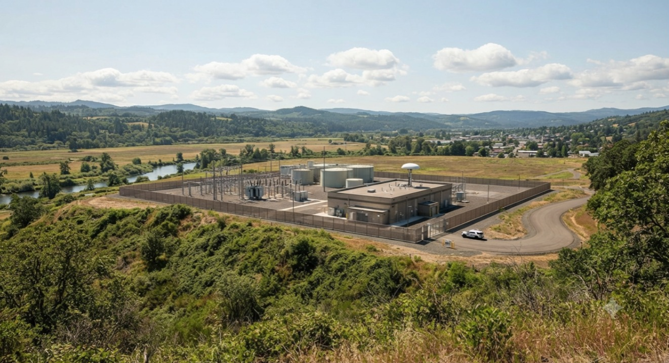
Critical infrastructure facilities operate in environments where security, continuity, and airspace awareness are essential. Power plants, utilities, airports, ports, government facilities, and other sensitive sites can face unauthorized drone activity that may create operational and security concerns.
As commercially available drones become more accessible, security teams need better visibility into low-altitude airspace around protected locations. A drone detection system helps authorized teams identify UAV activity, receive alerts, understand drone locations and flight paths, and make informed decisions according to established security procedures.
AirSentinel provides 360° airspace visibility through scalable solutions designed for real-time monitoring, helping organizations build a clearer picture of activity around critical sites.
Why Airspace Visibility Matters
Traditional security systems are primarily designed to monitor activity on the ground. Unauthorized drones introduce another dimension of security because they can enter restricted airspace, observe sensitive operations, or approach protected areas from above.
The first step in managing this risk is understanding what is happening in the surrounding airspace. Before security teams can determine whether drone activity is authorized, suspicious, or potentially threatening, they need reliable detection and tracking information.
Real-time drone detection can provide security teams with visibility into drone presence, location, flight activity, and other available identification information. This allows teams to assess events and follow their own response procedures.
What a Drone Detection System Does
A drone detection system monitors surrounding airspace to identify UAV activity, generate alerts, and help authorized users understand where a drone is located and how it is moving.
AirSentinel’s approach focuses on simple, affordable, and reliable airspace management. Its solutions combine detection technology with cloud monitoring, mobile access, geofencing tools, shared alerts, and watchlists.
The platform is designed to inform and empower users. It does not jam signals or take control of drones. When an alert is generated, the responsible security team can assess the information and decide whether to track the activity, notify authorities, or activate established security protocols.
What Security Teams Need to Monitor
1. Drone Presence and Identification
Modern drone detection systems can identify both Remote ID-compliant drones and non-Remote ID drones. AirSentinel AMS V8 provides 360° real-time detection of Remote ID and non-Remote ID drones.
For more advanced identification requirements, AMS V8 Pro uses a multi-band SDR system to identify unauthorized drones, including custom-built and legacy UAVs.
This visibility helps security teams understand what is entering protected airspace rather than relying only on drones that broadcast identification signals.
2. Location and Flight Path
Knowing that a drone is present is only one part of airspace monitoring. Security teams also need useful information about its activity.
Depending on the detection data available, teams can monitor details such as:
- Drone location
- Flight path
- Altitude
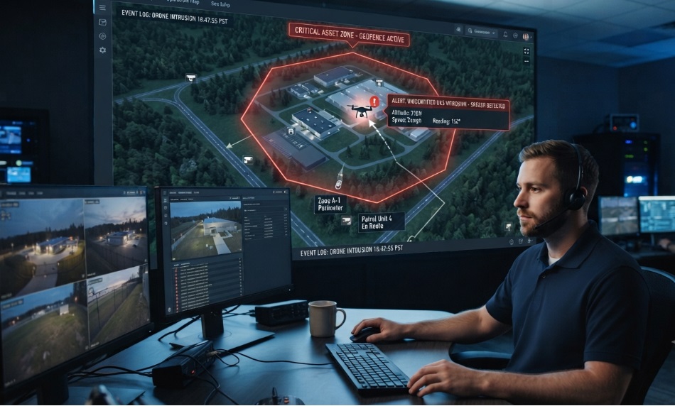
- Speed and heading
- Live tracking information
- Historical activity
This information can help teams understand whether a drone is approaching a restricted area, repeatedly entering protected airspace, or following an unusual flight pattern.
3. Pilot or Operator Location
For supported Remote ID activity, detection systems can provide information about the drone and its associated pilot or remote controller location.
AirSentinel provides alert information that can include separate map locations for the drone and pilot. This gives authorized teams additional context when assessing an incident.
4. Geofence Breaches and Custom Alerts
Security teams can establish geofences around areas that require additional monitoring. When drone activity enters a defined area, alerts can be generated for designated users.
The AirSentinel Cloud Platform provides real-time drone detection, alerts, and airspace monitoring through a centralized environment.
Drone incidents may involve multiple security teams or partner organizations. AirSentinel allows alerts and watchlists to be shared with partner agencies and organizations, supporting collaborative monitoring.
This can help teams maintain a more consistent picture of airspace activity across different locations and operational groups.
AirSentinel Solutions for Critical Infrastructure
AirSentinel AMS V8
AirSentinel AMS V8 provides 360° real-time detection of Remote ID and non-Remote ID drones. It supports fixed and mobile deployment options for different operational requirements.
The system includes features such as LTE connectivity for cloud integration, a weather-proof cabinet for outdoor deployment, a simplified Ethernet connection, and standard power operation.
Detection range varies depending on the environment. AirSentinel states that typical detection averages 3–5 miles, while the AMS V8 Pro can detect drones up to 10 miles away in wide, open, flat environments.
AirSentinel AMS V8 Pro
AirSentinel AMS V8 Pro is designed for advanced identification requirements. It uses a multi-band SDR system for precise identification of unauthorized drones and supports detection of custom-built and legacy UAVs.
The AirSentinel Cloud Platform brings real-time drone detection, alerts, and airspace monitoring into a centralized cloud environment.
It supports unlimited users and watchlists without per-user licensing fees and allows organizations to add sensors as their monitoring requirements expand.
AirSentinel Mobile App
The AirSentinel Mobile App provides an additional option for rapid or supplementary monitoring. The Android app can turn a phone into a real-time Remote ID drone detection tool.
AirSentinel states that the app can detect Remote ID drones within 1,000–5,000 feet, requires no account, and that iOS support is coming soon.
Critical Infrastructure Use Cases
AirSentinel solutions can support different environments where unauthorized drone activity requires monitoring.
Airports and Transportation Hubs
Airports need continuous awareness of nearby airspace to help identify unauthorized drone activity that could affect operations. Real-time detection provides security teams with information they can assess before an incident escalates.
Energy and Utility Sites
Power plants, substations, oil and gas facilities, and mining operations can use drone detection to monitor activity around sensitive industrial locations and improve awareness of unauthorized aerial activity.
Correctional Facilities
Drone detection can help identify unauthorized UAV activity around correctional facilities, including potential attempts to deliver contraband or conduct unauthorized surveillance.
Maritime and Ports
Ports and maritime facilities can monitor airspace around cargo operations, shipping infrastructure, and other sensitive areas where unauthorized drone activity could create operational concerns.
Military and Government Facilities
Sensitive government and military environments can benefit from real-time airspace awareness, detection, identification, and information sharing around protected locations.
Public Events and Stadiums
Large public gatherings can require additional airspace monitoring to identify unauthorized drones around crowds and protected event areas.
The AirSentinel Monitoring Process
A practical drone monitoring workflow can be organized into five stages:
| Stage |
What the Platform Provides |
Operational Value |
| Detection |
360° real-time drone activity |
Awareness of nearby airspace |
| Alerting |
Real-time notifications |
Faster review by authorized users |
| Identification |
ID, location, and flight path |
Better understanding of the event |
| Collaboration |
Shared alerts and watchlists |
Coordinated monitoring |
| Response |
User-directed procedures |
Teams remain in control |
AirSentinel monitoring flow:
Detect → Alert → Identify → Share → Respond
Why Organizations Choose AirSentinel
Scalable
Organizations can add sensors as their monitoring requirements grow while managing users and watchlists through the cloud platform.
Collaborative
Alerts and watchlists can be shared with partner agencies and organizations to support coordinated monitoring.
Cost-Effective
AirSentinel states that it provides inclusive pricing with no per-user fees and free access for first responders.
Simple and Intuitive
Dashboards and geofencing tools are designed to simplify airspace management and make monitoring information easier for authorized teams to understand.
Cloud-Native
The cloud platform provides real-time updates without requiring organizations to manage their own monitoring servers.
Choosing the Right Drone Detection Setup
The right configuration depends on the operational requirements of the site.
A fixed deployment may be suitable for a permanent critical infrastructure facility, while a mobile deployment can support changing locations or temporary operations.
AMS V8 is designed for 360° real-time detection of Remote ID and non-Remote ID drones. AMS V8 Pro is intended for more advanced identification through its multi-band SDR technology.
Organizations that require centralized access can use the Cloud Platform, while the Mobile App provides an additional option for Remote ID monitoring through Android devices.
Geofencing, alerts, watchlists, and shared information can also be incorporated into an organization’s airspace monitoring process.
Frequently Asked Questions
What is a drone detection system?
A drone detection system monitors airspace to identify UAV activity, provide alerts, and help authorized users understand a drone’s location and flight path. AirSentinel provides these capabilities through its detection solutions and Cloud Platform.
Can AirSentinel detect Remote ID and non-Remote ID drones?
Yes. AirSentinel AMS V8 provides 360° real-time detection of Remote ID and non-Remote ID drones. AMS V8 Pro is designed for precise identification of unauthorized drones, including custom-built and legacy UAVs.
AirSentinel provides alert information such as drone ID, location, and flight path. Authorized users can then assess the activity and follow their own procedures, such as tracking the drone, notifying authorities, or activating established security protocols.
Does AirSentinel jam signals or take control of drones?
No. AirSentinel is designed to inform and empower users. It does not jam signals or take control of drones. Response decisions remain with the responsible security team.
How far can the AirSentinel Mobile App detect Remote ID drones?
AirSentinel states that its Android Mobile App can detect Remote ID drones within 1,000–5,000 feet. The company also states that no account is required and that iOS support is coming soon.
How far can AirSentinel detection systems detect drones?
Detection range depends on the environment and deployment conditions. AirSentinel states that typical AMS V8 detection averages 3–5 miles, while AMS V8 Pro can detect drones up to 10 miles away in wide, open, flat environments.
Monitor the Airspace Around Your Site
Critical infrastructure teams need practical visibility into the airspace around their facilities. A modern drone detection system can bring together real-time detection, alerts, identification details, flight-path information, cloud monitoring, mobile access, geofencing, and collaborative watchlists.
AirSentinel provides scalable solutions that help authorized teams monitor UAV activity and maintain control over how detected events are assessed and handled.
Explore the AirSentinel drone detection system to review available solutions and discuss your airspace monitoring requirements.

 BLOG · SEP 22, 2026