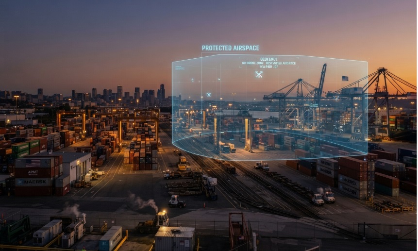
A port can secure gates, fences, and waterside access points yet still have an unmonitored approach overhead. Drone detection for maritime security gives terminal operators, port authorities, and vessel-security teams visibility into low-altitude activity around berths, cargo areas, cranes, fuel infrastructure, restricted facilities, and vessels at anchor.
That visibility matters because drones can be used for unauthorized observation, operational disruption, contraband delivery, reconnaissance, or attempts to distract security teams. A good program does not treat every drone as a hostile event. It gives operators enough information to separate authorized activity from activity that requires review, escalation, and documentation.
Why Ports and Vessels Need Low-Altitude Awareness
Maritime facilities are unusually exposed to small unmanned aircraft. Large outdoor footprints, open water approaches, tall structures, moving cargo, changing vessel positions, and round-the-clock operations create conditions where a drone can appear quickly and be difficult to identify visually.
The consequences are broader than physical damage. A drone near a container terminal may reveal cargo-handling patterns or security-posture details. A flight near a tanker berth, liquefied-gas facility, naval asset, or critical control area can trigger operational caution even when the aircraft is not carrying a payload. The security objective is to detect activity early enough to make a proportionate, documented decision.
What Drone Detection for Maritime Security Does
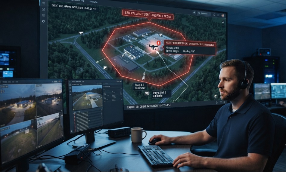
Drone detection for maritime security uses sensors and software to monitor defined airspace and alert security teams when a detectable unmanned aircraft enters the area. Depending on the technology and the drone, the operator may see a location, flight path, altitude, identifier, controller-related information, and alert history.
Detection is distinct from mitigation. Detection systems create awareness and support decision-making; they do not automatically jam, seize, or disable an aircraft. That distinction is especially important for US port operators, which must coordinate any response beyond observation and reporting with the appropriate authorized agencies.
Maritime Threats a Detection Program Must Address
- Unauthorized photography or reconnaissance of terminal operations, security controls, cargo areas, or vessel movements
- Smuggling or contraband delivery over perimeter controls
- Disruption of cargo handling, crane activity, vessel movements, or restricted-area operations
- Drone activity near sensitive energy, defense, or communications infrastructure
- Multiple or repeat flights that may indicate surveillance, testing of response procedures, or coordinated activity
A detection program should be designed around these scenarios and the decision each scenario requires—not around a single sensor specification. The operational question is: what information must the team have to classify the event, protect people and operations, and notify the right partner?
Technologies That Work in Port Environments
Ports are challenging sensor environments. Metal cranes and structures can complicate radio and visual paths; ships, equipment, birds, and weather can affect radar and camera performance; and marine radios and other communications create RF noise. For that reason, mature programs assess layered sensing rather than assuming one technology will cover every threat.
RF and Remote ID Detection
RF detection listens for drone-control and broadcast signals. Remote ID detection can reveal identifying and location information from compliant drones that transmit it. In a port, this is useful for quickly distinguishing known, approved activity from an aircraft that needs review.
Its limitation is equally important: an RF or Remote ID sensor cannot be assumed to identify every drone. Autonomous, modified, legacy, or non-broadcasting aircraft may not provide the same information. Coverage also depends on antenna placement, terrain, obstructions, and the surrounding RF environment.
Radar Detection
Radar identifies physical objects rather than relying on their communications. This makes it valuable when the concern includes RF-silent or autonomous drones, particularly over open water and in low-light conditions. Radar performance, however, requires site-specific configuration to manage birds, sea clutter, structures, and other moving objects.
For most port deployments, radar is strongest when it works alongside another sensor or verification method. A radar track may indicate an object of interest; an RF hit or camera view can help an operator decide whether it is a drone and how urgently to act.
EO/IR and Thermal Verification
Electro-optical and infrared cameras add visual confirmation. They can help operators verify a track, assess direction of travel, and document an incident. Thermal capability can be useful at night, but cameras need line of sight and can be affected by weather, lighting, glare, and crane or building obstructions.
Cameras generally work best as a verification layer that is cued by a radar or RF alert, rather than as the only way to find a small aircraft across a large terminal.
Why Sensor Fusion Matters
Sensor fusion brings information from RF, Remote ID, radar, cameras, and other available inputs into a single operating picture. The value is practical: it can reduce uncertainty, help limit false-alert fatigue, and show security personnel a clearer sequence of events.
For example, an RF signal may identify a broadcasting aircraft, radar may maintain its track across an open-water approach, and a camera may provide visual confirmation near a berth. The operator sees one incident to assess rather than several disconnected alarms.
Building a Practical Detection Workflow
Technology creates value only when the port has a defined workflow after an alert. The following sequence gives a useful baseline for a maritime detection program.
- Define protected zones. Map berths, crane corridors, fuel areas, control rooms, vessel approaches, and other locations where drone activity requires special review.
- Monitor continuously. Use fixed sensors for persistent coverage and mobile tools to extend awareness during patrols, temporary operations, or vessel movements.
- Validate the alert. Check available identifier, location, direction, confidence level, and corroborating sensor data.
- Check authorization. Compare the event with approved drone operations, contractor permissions, and temporary flight-related notices.
- Classify risk. Consider proximity to critical assets, flight behavior, repeated activity, time of day, and potential operational impact.
- Escalate through the port plan. Notify designated security leadership and the appropriate law-enforcement or government partner when required.
- Preserve records. Retain time-stamped alert data, screenshots, operator notes, and related communications for incident review and compliance.
Designing Coverage for Ports and Vessels
A coverage plan should start with the operating environment, not a generic range claim. A container terminal, cruise terminal, shipyard, offshore facility, and vessel on patrol each have different sightlines, risk zones, mounting options, communications paths, and staffing models.
- Survey the site for obstructions, RF interference sources, waterfront approach paths, and blind areas
- Prioritize high-consequence zones before trying to cover every square foot
- Plan for power, network resilience, weather exposure, maintenance access, and secure equipment mounting
- Use overlapping sensor coverage where one missed alert would carry significant operational or safety consequences
- Test the workflow with actual security teams, not only the equipment installer
- Review sensor placement after changes to cranes, buildings, berth usage, or operating procedures
For vessels, the design must account for movement, changing coastline geometry, vibration, weather, connectivity, and the need to share alerts with shore-side teams. Mobile capability is useful, but it should feed the same reporting and escalation process as the fixed-port system.
Legal and Governance Considerations in the United States
US operators should separate airspace awareness from counter-drone intervention. In general, detecting and documenting activity supports security operations, while jamming, spoofing, taking control of, damaging, or shooting down a drone can implicate federal aviation, communications, and criminal laws. Port security leaders should establish response roles with legal counsel and the relevant law-enforcement partners before an incident occurs.
A written governance plan should define who receives alerts, who verifies authorization, when a vessel or terminal operation changes posture, who contacts public-safety agencies, and how incident data is retained. Clear governance prevents a real-time alert from turning into an improvised decision.
How to Evaluate a Maritime Drone Detection System
A system demonstration should answer operational questions, not just show a dashboard. Use the following criteria when comparing options:
| Evaluation area |
What to ask |
| Detection coverage |
Which drone types and signal conditions can the system detect, and what coverage is realistic at this site? |
| Port environment |
How will metal infrastructure, ship communications, weather, birds, and sea clutter affect performance? |
| Verification |
Can RF, radar, and camera inputs be viewed and correlated in one workflow? |
| Alert quality |
How are confidence, prioritization, false alerts, and repeat flights handled? |
| Integration |
Can alerts support existing security operations, incident records, maps, and partner-agency procedures? |
| Deployment |
What is required for mounting, power, connectivity, weather protection, and maintenance? |
| Scalability |
Can the program expand across terminals, gates, vessels, and temporary operations without a fragmented toolset? |
| Governance |
Does the solution support lawful detection, audit trails, user permissions, and controlled sharing? |
AirSentinel for Maritime and Port Airspace Awareness
AirSentinel offers drone-detection and airspace-monitoring capabilities for critical infrastructure, including maritime and port environments. Its maritime page positions the platform around identifying unauthorized drone activity near port facilities, while its AMS solution supports real-time airspace monitoring and alerting.
For a port program, the relevant evaluation is how AirSentinel’s sensors, cloud platform, and mobile monitoring capabilities fit the site design and security workflow. A discussion should address protected zones, expected RF conditions, available mounting locations, alert recipients, mobile patrol requirements, and coordination with local and federal partners.
To explore a site-specific approach, link the call to action to AirSentinel’s Maritime and Ports page or AMS solution page and request a coverage assessment rather than relying on a generic coverage estimate.
FAQs
1) What is drone detection for maritime security?
It is the use of sensors and software to monitor low-altitude airspace around ports, terminals, vessels, and related infrastructure. The system alerts security teams to detectable drone activity and provides available information for assessment and escalation.
2) Can a port detect drones that do not transmit Remote ID?
It may be possible with technologies beyond Remote ID alone, such as RF analysis for supported signals and radar for physical detection. The result depends on the drone, sensor configuration, environmental conditions, and the site layout.
3) Why is sensor fusion important at a port?
Ports contain RF noise, metal structures, birds, moving equipment, and changing weather. Combining sensor inputs can help operators validate alerts and avoid making decisions from one incomplete data point.
4) Does a detection system automatically stop a drone?
No. Detection systems provide situational awareness. Any intervention must be handled only by entities with the appropriate legal authority and according to an established response plan.
5) What should a port team do after a drone alert?
Validate the alert, check whether the flight is authorized, assess proximity and behavior, notify the designated security lead, escalate when necessary, and preserve incident records.
6) Can a vessel use drone detection equipment?
Yes, but shipboard deployment requires planning for movement, weather, connectivity, equipment mounting, and coordination with shore-side or maritime-security teams.
7) How should a port choose a drone detection provider?
Compare real site coverage, supported detection methods, alert quality, sensor integration, deployment requirements, workflow fit, scalability, and the provider’s ability to support lawful operational processes.

 BLOG · SEP 22, 2026