A drone alert is valuable only when it gives a security team enough time and context to make a sound decision. That is why real-time alerts are changing enterprise airspace security: they turn an uncertain sighting into a coordinated workflow built around location, identity, movement, priority, and response ownership.
For a security operations center, the difference is significant. A delayed report may tell operators that a drone was seen somewhere nearby. A timely, enriched notification can show where the aircraft is, whether it entered a protected zone, what information is available about the signal, and which procedure should begin next. The technology does not replace human judgment. It gives people better information before the situation develops.
Traditional perimeter security is designed around doors, fences, cameras, badge readers, and motion sensors. Drones complicate that model because they can approach from above, cross boundaries without touching them, and leave before a patrol reaches the reported location. A guard who receives a radio call several minutes after a sighting may have little chance of finding the aircraft or its operator.
This is where real-time alerts change the operating picture. Instead of treating drone activity as a disconnected observation, a security team can see it as an active airspace event. The earlier the team receives a useful notification, the more options it has: verify the activity, protect a sensitive operation, move people away from a risk area, notify law enforcement, or continue monitoring without unnecessary escalation.
What makes a drone alert actionable?
Speed is necessary, but context is what matters
Fast delivery matters, but speed alone does not create situational awareness. An alert that simply says “drone detected” can generate confusion, especially at a busy site where authorized and unauthorized flights may occur at the same time. A useful alert should help the recipient answer five questions quickly: What was detected? Where is it? When did it enter? Why does it matter? Who owns the next action?
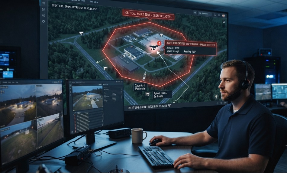
Depending on the sensor and environment, relevant context may include detection time, estimated position, altitude, direction of travel, flight path, zone status, available Remote ID information, sensor source, confidence level, and links to related camera or incident records. The platform should present this information clearly rather than forcing an operator to search across multiple screens.
The alert should support a decision
Security teams do not need more notifications for their own sake. They need notifications that connect to a decision framework. A low-priority observation near a public boundary may require logging and continued monitoring. A drone approaching a restricted area during a sensitive operation may require immediate escalation. The same aircraft can therefore have different priorities depending on location, timing, authorization, and behavior.
A strong workflow uses geofences, watchlists, user roles, and escalation rules to add this context. AirSentinel describes geofencing, watchlists, cloud monitoring, and scalable access as part of its platform approach. [web:6] These controls can help organizations organize alerts around the way their sites actually operate.
How real-time detection changes the security workflow
1. Detect activity at the edge of the protected area
The first change is visibility. A detection system can monitor the airspace around a site rather than waiting for a person to notice an aircraft overhead. Depending on the deployment, organizations may use Remote ID monitoring, radio-frequency analysis, software-defined radio, radar, acoustic sensors, cameras, or a combination of methods. No single sensor is perfect in every environment, so coverage and operating conditions should be evaluated during planning.
Early real-time alerts give operators a chance to assess the event before it reaches a high-consequence area. That extra time can be more valuable than a dramatic last-minute response.
2. Verify and classify the event
Detection is not the same as intent. The next step is to determine whether the activity is authorized, unknown, or suspicious. Operators can compare the event with approved flight schedules, known aircraft, geofences, Remote ID data where available, and the drone’s observed behavior. A platform that preserves the event timeline also helps teams distinguish a brief pass from repeated circling or a deliberate approach.
This verification stage reduces two common risks: ignoring a genuine intrusion and overreacting to a permitted flight. It also gives supervisors a defensible basis for escalation.
3. Prioritize the threat
Not every detection deserves the same response. Priority can reflect the protected zone, proximity to people or sensitive assets, flight direction, time of day, event conditions, and whether the aircraft is identifiable. A practical model might classify incidents as monitor, investigate, escalate, or emergency response.
The goal is not to automate a legal or tactical decision that belongs to trained personnel. The goal is to make the decision faster and more consistent by placing the relevant facts in front of the right operator.
4. Coordinate the response
Once an event is prioritized, real-time alerts can route it to the people who need to act. That may include a SOC operator, site security, an event command post, an aviation coordinator, a facility manager, or a public-safety partner. Delivery channels can include a dashboard, email, SMS, mobile application, collaboration platform, VMS, or SIEM, depending on the organization’s technology stack and response policy.
Coordination is especially important when teams are distributed across buildings, shifts, or agencies. A shared view of the event reduces duplicated calls and makes it easier to establish who is responsible for verification, communication, documentation, and follow-up.
5. Record and learn from the incident
A response should not disappear when the drone leaves. Event history, alert timestamps, flight paths, operator actions, screenshots, and related video can support post-incident review. Over time, those records may reveal recurring approach routes, nuisance areas, gaps in sensor coverage, or procedures that create unnecessary delays.
This turns drone detection from a one-off alarm function into an improvement loop. Security leaders can use the evidence to refine geofences, update watchlists, adjust staffing, train operators, and communicate more effectively with local partners.
Why this matters across enterprise environments
Critical infrastructure and industrial sites
Power, energy, manufacturing, mining, and other industrial locations often combine large perimeters with sensitive equipment and restricted processes. A drone may be used for observation, photography, disruption, or an unknown purpose. Real-time alerts help the team focus attention on the relevant zone and protect operations without treating every aircraft as an emergency.
Airports, ports, and transportation locations
Transportation environments require disciplined coordination because an aerial event can affect safety, schedules, and multiple stakeholders. Detection data can support a common operating picture for security, operations, and authorized aviation personnel. Response procedures should be aligned with site policy and applicable authorities rather than improvised during an incident.
Corporate campuses and executive protection
Corporate security teams may be concerned about privacy, facility reconnaissance, intellectual property, or the safety of executives and visitors. A live alert with location and movement information can help teams decide whether to monitor, reposition personnel, protect a sensitive activity, or coordinate with authorities. Cloud access is useful when the team must monitor more than one site or work from a central operations function.
Public events, stadiums, and universities
Crowded venues have little tolerance for uncertainty. Security teams need to distinguish a permitted production flight from an aircraft approaching spectators, performers, or restricted zones. Pre-event geofences and escalation rules can help teams establish expectations before doors open, while event records support post-event review.
Correctional facilities and public safety
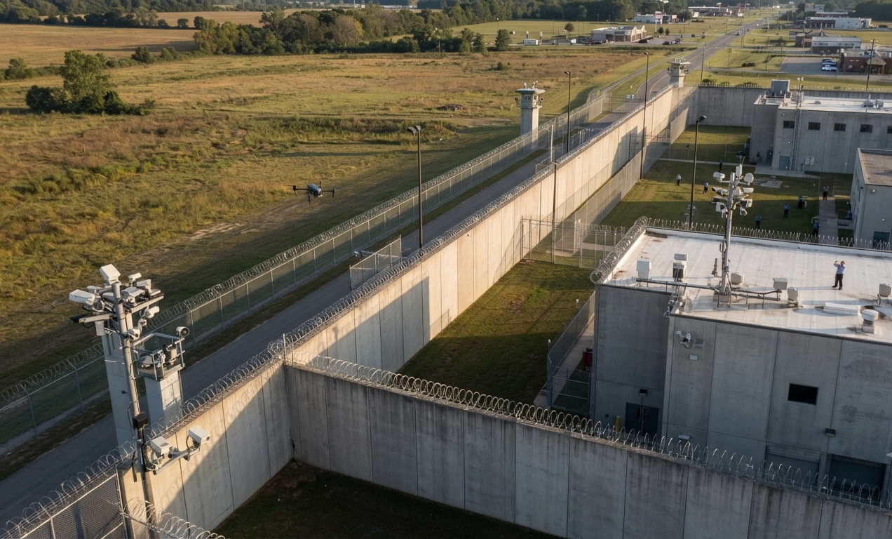
Correctional and public-safety environments may face concerns involving contraband delivery, surveillance, or interference with operations. Rapid notification gives officers more time to secure vulnerable areas and coordinate a response. Any action beyond detection and reporting should follow the organization’s legal authority, training, and established protocols.
Build an alert workflow—not a notification pile
Define zones and escalation rules
Start by mapping the airspace that matters. Create zones for general awareness, restricted activity, high-sensitivity assets, landing areas, crowds, and temporary operations. Then define what should happen when a drone enters each zone. Clear rules prevent every event from being treated as equally urgent.
Route alerts to the right people
A notification should reach someone who can act. Use role-based routing, on-call schedules, backup recipients, and acknowledgement procedures. If an alert is not acknowledged within the defined period, the workflow should identify the next escalation point. This is more reliable than sending every alert to every user.
Connect detection to existing systems
The best deployment fits the security environment already in place. Depending on the organization, useful connections may include video management, access control, SIEM, case management, mapping, mass notification, or collaboration tools. Integration reduces manual copying and gives responders a more complete incident record.
Measure response quality
Track more than detection counts. Useful operational measures include time to alert, time to acknowledgement, time to classification, escalation accuracy, false-alarm rate, percentage of alerts with complete context, and closure quality. These measures help leaders improve the workflow without rewarding teams simply for generating more alarms.
When comparing systems, security leaders should evaluate the complete path from sensor input to decision support. Important questions include:
- Which drone types and signals can the system detect, and what limitations apply in the intended environment?
- How are Remote ID and non-Remote ID events handled?
- What information accompanies an alert, and can operators see the event on a map?
- Can the platform create geofences, watchlists, roles, and escalation rules?
- How are alerts delivered during normal operations and system outages?
- Can the system integrate with existing VMS, SIEM, collaboration, or incident-management tools?
- Can multiple sites, users, and partner organizations share appropriate information?
- What audit history and export options are available for investigations and reviews?
- What are the deployment, support, cybersecurity, training, and licensing requirements?
AirSentinel presents several capabilities that are relevant to this evaluation, including AMS V8 and AMS V8 Pro detection options, a cloud platform, a mobile application, industry-specific deployments, and a model designed for scalable users and watchlists. [web:6] Buyers should validate technical performance and integration requirements in their own environment before making a procurement decision.
A practical response playbook
A simple playbook can help turn real-time alerts into repeatable action:
- Receive: Confirm that the alert arrived through the approved channel and note the detection time.
- Assess: Review location, movement, zone, identity information, sensor confidence, and any related video.
- Classify: Mark the event as authorized, unknown, suspicious, or emergency according to site policy.
- Assign: Identify the person or team responsible for the next action and set an acknowledgement deadline.
- Protect: Apply approved measures to protect people, operations, and sensitive assets.
- Coordinate: Notify internal leaders or external authorities when the situation and legal framework require it.
- Document: Preserve the alert, decisions, communications, and outcome.
- Improve: Review the event and update the map, rules, training, or coverage plan if necessary.
The central principle is straightforward: a detection system should shorten the distance between observation and informed action. The most effective real-time alerts do not merely arrive quickly; they arrive with the context, routing, and accountability needed to make the next decision clear.
FAQs
1) What are real-time alerts in drone detection?
They are near-immediate notifications that a drone or relevant airspace event has been detected. Depending on the system, an alert may include location, time, direction, altitude, identity data, zone status, and links to related evidence.
2) Why are real-time alerts important for security teams?
They reduce the delay between detection and response. Earlier, better-contextualized information gives teams more time to verify the event, protect people or assets, coordinate internally, and follow established procedures.
3) Do real-time alerts automatically stop or disable a drone?
No. Detection and notification platforms generally provide information for authorized personnel to assess and respond. Any mitigation or enforcement action must follow applicable law, organizational policy, and trained procedures.
4) Can drone detection systems identify drones without Remote ID?
Capabilities vary by product, sensor, environment, and aircraft. Some systems support detection of non-Remote ID or custom drones through other sensing methods, but buyers should verify coverage and limitations for their site.
5) How can organizations reduce false alarms?
Use geofences, approved-flight schedules, watchlists, event context, multiple sensing methods where appropriate, clear severity rules, and operator training. Review false alarms regularly and adjust the workflow rather than simply silencing notifications.

 BLOG · SEP 22, 2026